

Constant dispute along Manipur's India-Myanmar border continues to create confusion and enragement in peripheral villages of the state.
Villagers of Nampisha and Phaikoh in Kamjong district have alleged that several villages in the district had been included in Myanmar's side of the border.
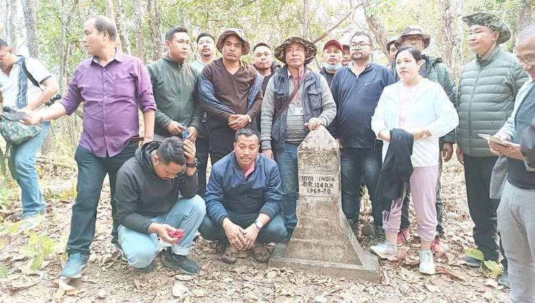
Continuing their inspection drive of border pillars along the India-Myanmar border, the United Committee Manipur (UCM) and a team of media persons on Wednesday inspected border pillar number 104 in Kamjong district.
Speaking to the media, chief of Phaikoh village Haosi Touthang stated that the map of Manipur online and the border pillars enacted did not coincide with each other.
"On the map it shows several villages of Manipur inside Myanmar's border, even Phaikoh village comes under Myanmar," he added.
He further questioned how Phaikoh village, which falls on India's side of the border pillar, be included in Myanmar's territory in Google Maps.
Haosi further pointed out that around 5 km of Manipur's land had been swallowed into Myanmar's territory. As such, the chief expressed disappointment with the Manipur government's utter disregard over the matter and urged authorities concerned to look into the matter at the earliest.
UCM president Joychandra Konthoujam stated that the border issue in Manipur had been stretched thin and needed urgent resolution. He maintained that the UCM had been conducting the inspection from border pillar number 67 to 104 and found several border pillars to be misplaced.
"The border pillars were enacted after agreement between the India and the Myanmar government, no opinions of villages along the border were taken into consideration," he added.
He expressed disappointment with the government's failure to stick to their resolutions and protect the borders according to the agreement.
"Both the state and Union government had failed to prevent Burmese encroachment or safeguard their border pillars," he said.
Joychandra highlighted that the border issue could be resolved by studying the census reports and demarcating the boundary of Kabaw valley. He also emphasised the need for proper implementation of the Rangoon agreement to resolve the dispute.
He urged the state government to table the border issue for discussion during the Assembly session and cautioned of strong agitation if the matter is not settled at the earliest.