

Manipur, a lush green picturesque state in North-eastern India, merged with the Indian Union on September 21, 1949. But what is the truth of the merger— the territorial shape and size of this Land of Jewels? Were the tribes and hills of the state included in the Merger territorial entity?
The truth is Manipur has a long and culturally rich history. It was once an independent princely state before it was taken over by the British in 1891. After India gained independence from British rule in 1947, India's first Home Minister Sardar Vallabhai Patel set about the task of integrating more than 500 princely states that existed in the Indian subcontinent with the newly formed Indian union. This process of integrating the princely states took place over a period of time. Manipur was one such princely state which merged with the India Union on September 21, 1949.
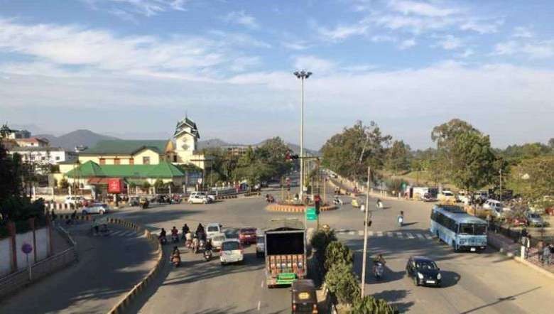
In order to understand how the merger of Manipur with India came about; we need to take a brief look at the geography and historical background of this “Jewel of India” with an oval-shaped valley, surrounded by rich hills.
Manipur is a landlocked state and shares its borders with the Indian states of Nagaland to its North, Assam to its West and Mizoram to its South. Towards the East and Southeast of Manipur is the neighbouring country Myanmar, with which Manipur shares a 352 km long international border.
In the early 1700s, both Manipur and Myanmar were independent kingdoms and the then King of Manipur, Maharaja Pamheiba or Garibaniwaj invaded his Eastern neighbour Burma (as it was then known) several times.
The Burmese rulers retaliated in 1890 and their fierce attack led to a period referred to as 'Seven years of devastation' in the history of Manipur.
Maharaja Gambhir Singh of Manipur sought refuge in the princely state of Cachhar (in present-day Assam) and reached out to the British for assistance, since they had advanced arms and armaments, which could help him wage war against the Burmese king and recapture his kingdom.
The British forces helped Maharaja Gambhir Singh's army and he was able to evict the Burmese forces and retake his kingdom.
In 1941, Meidingu Bodhchandra Singh became the ruler of Manipur. Bodhchandra Singh set up a committee to draft a constitution for a new government in Manipur. This task was completed in 1947 and in June 1948 the first election was held in Manipur. MK Priyobarta was elected the first chief minister of Manipur and a state assembly was formed.
Meanwhile, the Maharaja was asked to meet with representatives of the Indian Government in Shillong and after a few days of negotiations signed an instrument of accession with India on September 21, 1949.
Is the Manipur Merger territorial entity only 700 Square Miles?
On July 27, 2021, a ‘sensational’ information about the Maharaja was posted on Facebook by one user.
The truth about how the Maharaja of Manipur merged his kingdom into the Union of India is well recorded and published by Brigadier Sushil Kumar Sharma in his book the Complexities of Tribal Land Rights and Conflict in Manipur: Issues and Recommendations.
Five days earlier, on July 22, 2021, he posted, “Does Maharaja Sanajaoba Leishemba (The present titular king and Member of Parliament from Manipur) forgets the actual size of their kingdom merged into the Union of India? Tell him it was only 700 square miles.”
About 13 days prior to it, on July 9, 2021, he also wrote, “The Inner Manipur, which is geographically about 700 sq mile was annexed into the Union of India by Maharaja of Manipur (L) Bodha Chandra Singh through the very hand of VP Menon, the then adviser to the Government of India, Ministry of State on behalf of the Dominion of India on September 21, 1949 in Shillong.
“In as much, the inclusion of Outer Manipur (Hill Area), about 7,921 sq miles, into Manipur state in 1972, when Manipur became a Part-C state, is politically illogical since the Kuki chiefs were not consulted and, no evidence of agreement with the Government of India is available.”
The series of posts in July 2021 suggests that the person was deliberately challenging the facts and history of the ‘merger’ of Manipur to India in 1949. He identifies the shape and size of Manipur with the “Manipur valley” and argues that the ‘merger’ did not include the present hill districts of Manipur and the people who were then living there.
According to him, Manipur was never an entity comprising the present valley and hill districts. To substantiate his argument, he referred to the work of the Brigadier who has authored the book entitled - The Complexity Called Manipur: Roots, Perceptions & Reality. But the reference to the highlighted article, published in Issue Brief VIII (June 2017) by Vivekananda International Foundation, has a serious problem.
The problem is, when the author writes, “The total area which the Manipur merger agreement covered was his territory of 700 square miles or 26,500 paris/hectares,” it fails to cite any source to substantiate it. The sentence is a biased opinion without an iota of facts. It is unfortunate that the article, meant to be an academic chapter, seems published by bypassing a proper peer review by credible academics.
It is most likely that the Brigadier, who once was posted in Manipur, for the reason he alone can explain, relied on unauthenticated opinions of those who were advocating lies. Most probably, he has relied on a memorandum addressed to the President of India, dated 14th July 1999, submitted by the All Tribal Students’ Union Manipur (ATSUM), or, any other source identical with the memorandum.
For instance, the article contains two subheadings, i.e., (1) Merger of Manipur With the Indian Union, and (2) No Merger of the Tribal Chiefs and Their Territories - which are almost reproduction from the memorandum. Some sentences under these subheadings are exactly the same. The lines of arguments are the same. Both the article and the memorandum challenge the established geographical coverage of the ‘merger’ agreement. They argue that the hills and ‘tribes’ were never under the Manipur administration.
Ironically, while they refute the geographical coverage of the ‘merger,’ logically, it implies refuting any impact of the ‘merger’ on the ‘tribes’ and hills of Manipur. The weak point of their argument is that they are unable to substantiate what they are saying. They write anything they want. It may have different implications. But those texts or lines carry no academic value.
First, what was the geographical coverage of the ‘merger?’
Article No 1 of the “merger agreement,” signed on September 21, 1949, reads, “His Highness the Maharaja of Manipur hereby cedes to the Dominion of India Government full and exclusive authority, jurisdiction and powers for and in relation to the governance of the State and agrees to transfer the administration of the State to the Dominion Government on the fifteenth day of October 1949.”
The document is silent on the geographical coverage. Similar silences are found in the following documents that preceded the ‘merger,’ i.e., (a) the Agreement between His Highness the Maharaja of Manipur and His Excellency the Governor of Assam, dated 2nd July 1947, (b) the Standstill Agreement, and Instrument of Accession, dated 11th August 1947. These documents do not mention either 700 Sq miles or Manipur valley.
Practically, the agreements covered the entire Manipur. Geographical coverage was silent most probably because the need to mention it did not arise as Manipur was an undisputed and internationally recognized territorial entity.
However, the geographical coverage was reaffirmed in the Manipur Administration Order passed by the Government of India, dated October 15, 1949. It defines Manipur as, “the whole of the area which, immediately before the commencement of this order, is comprised within the state of Manipur.”
Second, did the King or Maharaja of Manipur represent only the valley and a particular community when he signed the “merger agreement?”
To answer this question let us examine at least two perspectives; First, — there can be no denying that the ‘merger’ was signed without popular consent. There was neither a plebiscite on merger nor ratification of the ‘merger’ by the Manipur Legislative Assembly.
The National Convention on Manipur Merger Issue (1993) resolved that “the Manipur Merger Agreement signed by and between the Maharajah of Manipur and the representative of the Dominion of India on 21st September 1949 did not have any legality and constitutional validity.”
Second, whether a section of the present generation likes it or not the “merger agreement” was a culmination of a series of agreements and instruments signed in 1947 in which the King of Manipur played ‘local’ deciding roles. All these recognized an entity called Manipur, i.e., a princely state with the King as the central figure.
Even during the colonial period after the “Anglo-Manipuri War” of 1891, the Manipur administration was organized from time to time in manners that certain designated British officials deputed in Manipur were entrusted with the executive power to administer the hills and tribes through the Manipur State Darbar on behalf of the King.
It was a Manipur administration in the name of the King.
When the British supremacy was collapsing the Manipur State Constitution Act 1947 and the Manipur State Hill Peoples (Administration) Regulation 1947, drafted by nominated influential persons from various communities, recognised the King as the constitutional head. For instance, the Regulation upheld that, “The responsibility for the administration of the Hill Peoples is vested in the Maharaja in Council and shall be exercised in accordance with the Constitution Act of the State and the provisions of this Regulation as amended from time to time.”
Against this backdrop, the British officials and Dominion of India used the King as the rallying point of “taking over” Manipur. Logically, when the King signed the “merger agreement” it was not for a particular community or a portion of the territory. He signed it for the entire Manipur and the population inhabiting it.
Third, was the “merger agreement” applied to a particular community and Manipur valley?
The impacts of the “merger agreement” were not confined to a particular community or a portion of the territory. First, following the ‘merger,’ Manipur became a part of India. The Manipur Administration Order of 15th October 1949 abolished the hard-earned Manipur State Assembly— established on 18th October 1948 by members from across communities who were elected through universal adult franchise. The entire Manipur became a directly occupied Part C State from January 26, 1950 onwards.
Second, if one would argue that the tribes and hills were not covered by the “merger agreement;” (a) there is no evidence to substantiate when they separately became part of India, (b) there is no explanation as to why tribal representatives were present in the 30 members Electoral College of Manipur constituted in 1952 and the Council of Advisors to the Chief Commissioner established in 1953, and (c) there is no reason why a tribal was elected to represent the Outer Manipur (hills and tribes) in the India Lok Sabha in 1952.
If the hills and tribes were not covered under the “merger agreement” it remains to be explained as to why the hills were the first to felt the impact of the Armed Forces Special Powers (Assam and Manipur) Act 1958.
All these exemplify that the “merger agreement” was applied to all.
Some sections are interested in manufacturing lies and misrepresenting history as the result of contemporary political influences and reactions. However, it is suggestive that the historical past is best studied and explained by locating it in its rightful historical time, space, and context.
The territorial shape and size of Manipur before the ‘merger’ are found in official reports, Imperial Gazette of India (1909 and 1931), Census of India Administrative Atlas, researches, etc.
Manipur on the eve of the ‘merger’ was a territorial entity composed of hills, valleys, lakes, rivers, swamps, and communities. One can challenge the concept of ‘merger’ and replace it with other political terms. But there are certain facts, whether one likes it or not, which cannot be refuted. No matter the volume of lies and fabrication are continuously manufactured to misrepresent the past, Manipur was ‘merged’ entirely as a territorial entity.
The merger territorial entity covered the Manipur valley and all those members of the villages in the hills listed in the Manipur State Hill Peoples (Administration) Regulation, 1947.
(The views expressed are personal)